- Run 50 mountain peaks in 50 days
- 1,659km of trail running (33km/day)
- 81,779m of total climbing (1635m/day)
- 427 hours of time on foot (8h30m/day)
The lowdown on Mal and the High-50
Mal Law is one of those passionate people. He loves a good challenge and is totally motivated and committed to is cause once he’s startes. He’s a regular on the New Zealand running circuit having completed many a Kepler Challenge, Tarawera Ultra and others to boot. His obsession with long-distance running made it to the forefront a couple of years ago when he ran the then “New Zealand’s 7 mainland Great Walks” in 7 days, back in 2009 (There are now nine Great Walks and I supported Ryan on smashing the record in 2016). Mal completed the 7 in 7 as it had never been done before and it proved to be a life-changing experience for him. He’s since written a book about the challenge and I’m sure one will come for the High-50 too (along with the cracking movie created by Flashworks Media). Like I said before, he does things with passion and all for a good cause – this time all for Mental Health New Zealand.
The High-50 Challenge was a true mountain challenge, played out over the length and breadth of NZ. It takes the shape similar to my own 52 Peaks challenge, taking place across New Zealand with an emphasis on peak bagging & trail running as well as bringing huge groups of people together on daily adventures in high places. However, as Mal says on his website, this Challenge exists really to bring the issues surrounding mental health out of the shadows and into the limelight.
Day 32: Mt Fyffe
My Fyffe sits proudly towering above Kaikoura on the East coast of the South Island. It’s 1602m high and climbs straight from the sea. I chose to support Mal on this challenge as I’d never been on the mountain before (even though it’s Kaikoura’s most accessible) but had ventured up the Hapuku River on my way to the summit of Manakau back in my 52 Peaks.
The Route
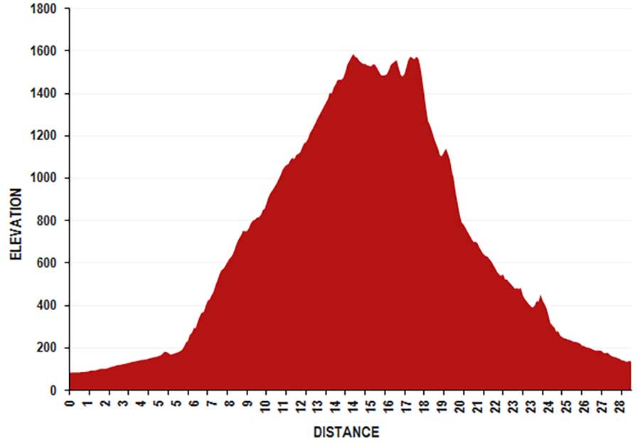
The route was to follow the 4×4 track from the flatlands to the north-west of Kaikoura, climb to the summit, along the ridgeline towards Gables End and drop down into the Hapuku River. The final section would be to run until we hit the road crossing, which lead us back into Kaikoura.
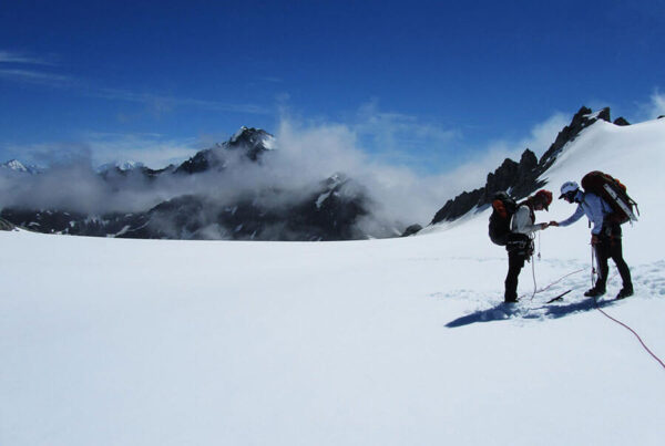
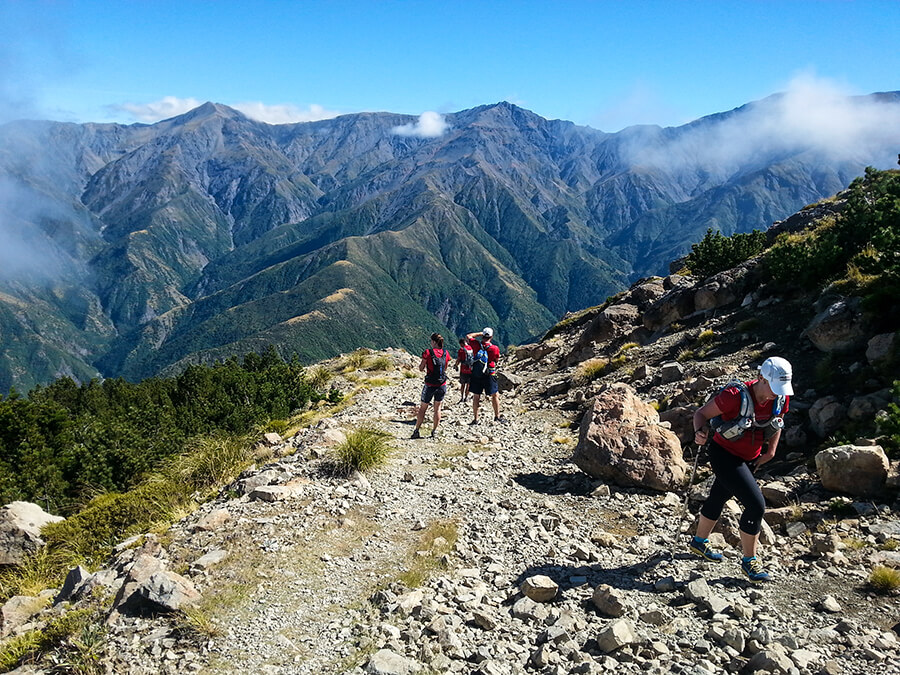
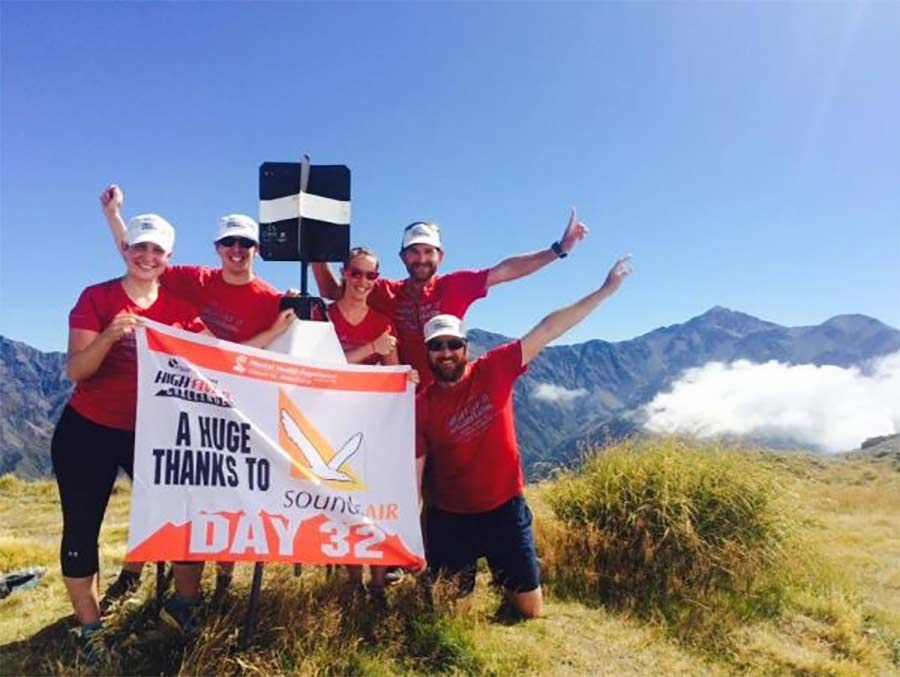
We met on the corner of Postmans Road and Red Swamp Road at 8am sharp, ready to take on Mt Fyffe. After brief introductions, we geared up and started on the 32km day. Mal was in high spirits, this being his 32nd peak of his challenge, after a lot of set backs throughout, he was keen to crack on with the second half of the mission.
The Climb
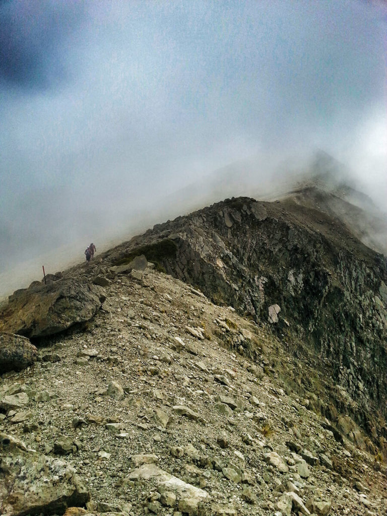
The first 6km was great, flat and winding 4×4 tracks until we hit the end of the vehicle access track… then it was most definitely UP. Climbing for the next 8.5km all the way from 180m to 1602m, it would be fair to say that it was brutal! Still, the views, the company and the scenery were well worth it.

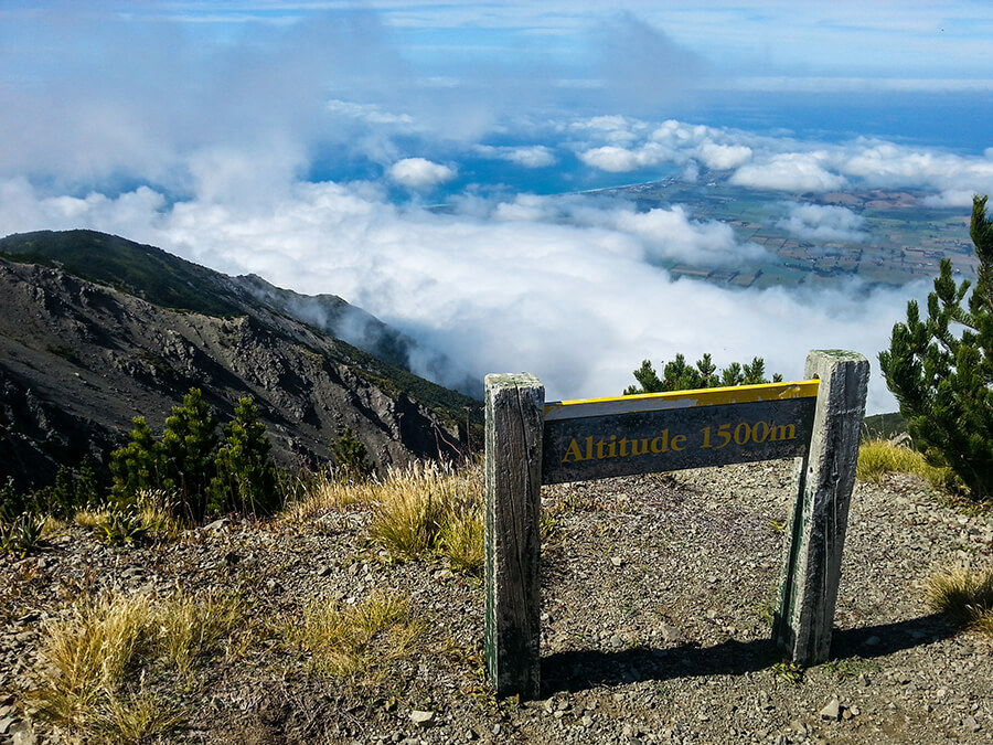
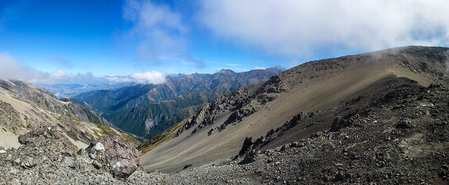
After a few hours of running we reached the top. The views once again did not disappoint as we posed for our summit photo, standing a mile above the Kaikoura peninsular. There was intermittent signal on the summit too, so Mal informed his support crew at the bottom of our progress so that they could find time to crack open a beer in time for the finish line at the Hapuku. The cloud kept on covering the land beneath us from time to time, but thankfully we managed to get some incredible blue sky and rest before we tackled the ridgeline towards Gable (1585m).

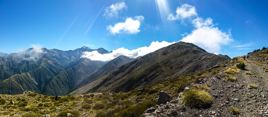
The Ridgeline
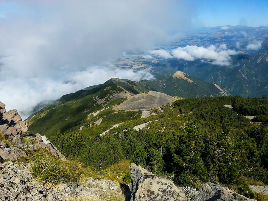
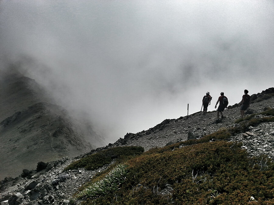
Having never climbed up Mt Fyffe before, I was amazed at the quality of the next section of ridgeline. It was stunning. Nice trails with a few technical rock sections, but a beautiful flowing ridgeline that wasn’t too scary or exposed. We kept a good speed going across the tops, the cloud blocking our view from one moment to another, making the rocks and jagged rocks stand out against the white. The descent from Gable to Gables End was a scree run for a couple of hundred meters. We took it steady on our ankles as we knew the big descent of Gables End was longer and tougher.
The Descent
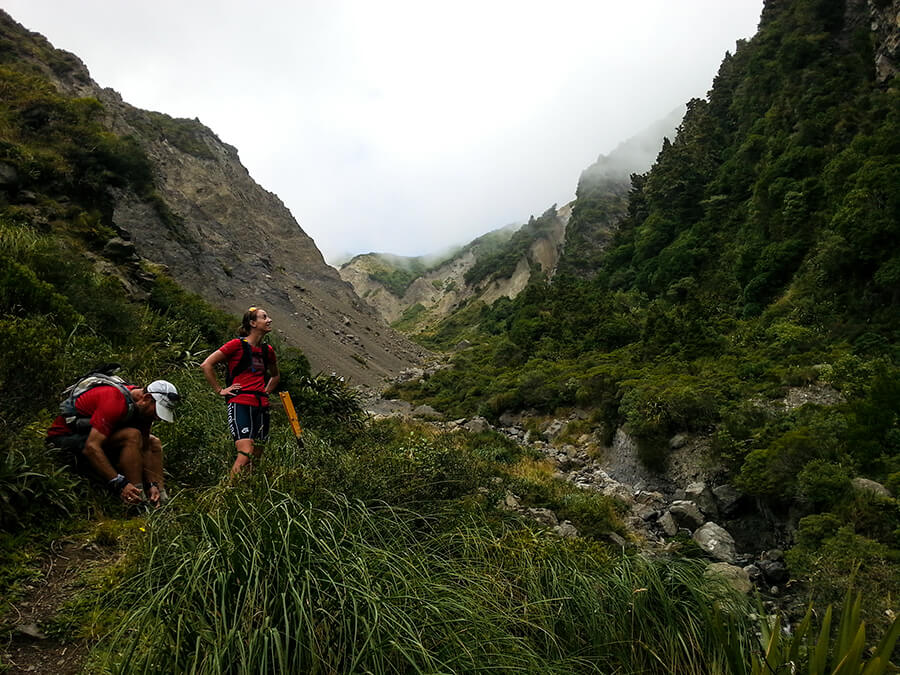
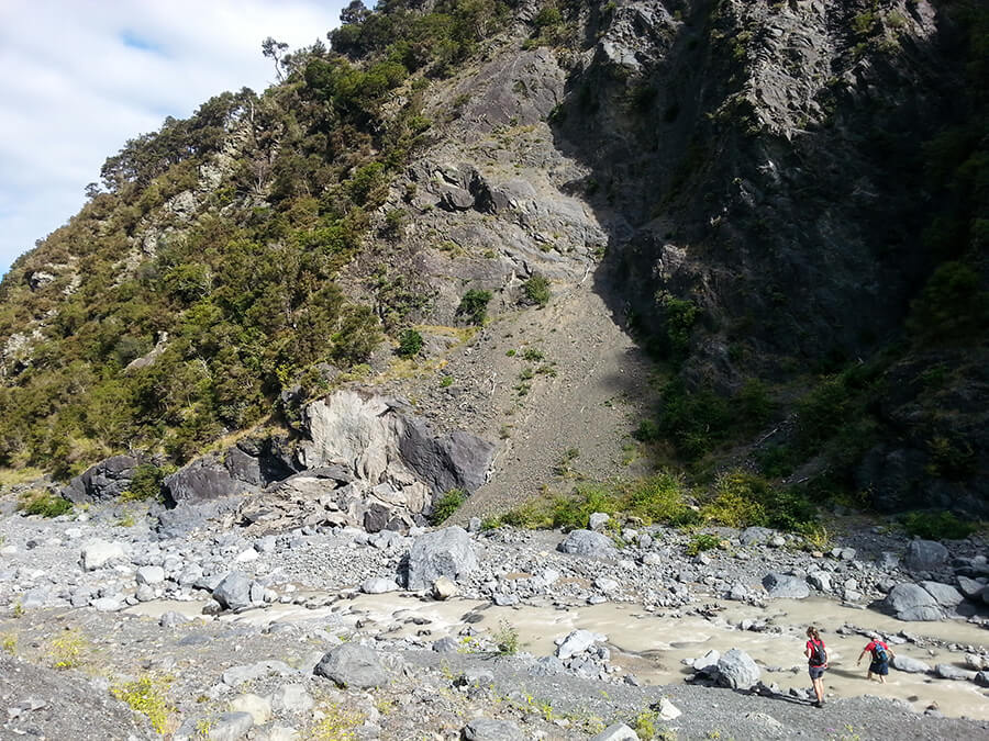
After hitting Gables End, the route was indeed a long scree run. It wasn’t good scree either. It was slippy and scrubby scree that ended up in a large steep sided clay looking valley – quite different from the tropical bush that we were expecting. We carried on through this steep sided valley, waist deep through rivers and knee deep in mud. Eventually we reached the bushline and some beautiful forest running towards Hapuku Hut, a 6 bunk hut halfway down the Hapuku, before the confluence at the end of Raven Spur.
The Final River Run
After Hapuku Hut (and Mal falling face first in the Hapuku River), we descended to the main river valley after climbing over the end of Raven Spur. The river became very wide and fast flowing meaning that we had to pick and choose where to cross and which direction across the floodplain to run.
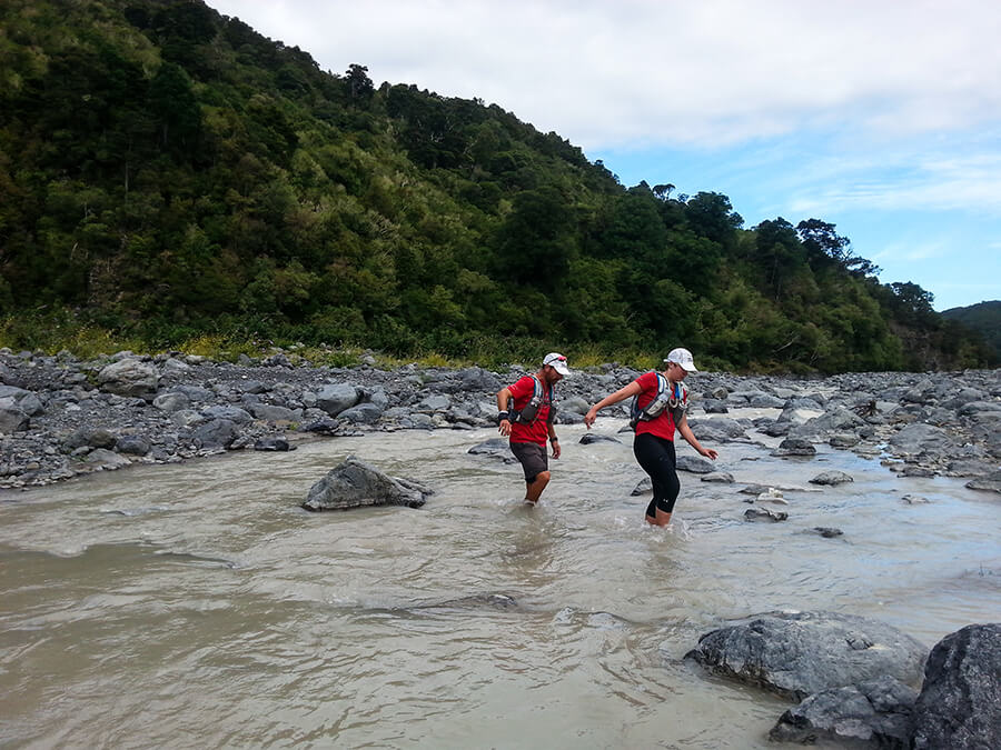
After crossing the river for a million times, we heard the faint hum of a drone in the distance. Thankfully that meant that we were in range of the support vehicles as the batteries on those drones is only 15minutes! As if by magic, the drone flew over the trees ahead of us and started filming our final few crossings en route to the finish.
We hit the 4×4 trail and were met by the crew, beers and our own medals for supporting the day. 20 minutes of rest later, Mal was off and the support crew had disappeared – he was off to St Arnaud, along the 230km drive to Day 33 and Angelus Peak!
High-50: The Movie
FIFTY – The Movie is now out and released to the general public. Watch the teaser of Mal’s film below: